Statera Energy
Ness Weir II
Have your say
Public Consultation
Our public consultation events have now concluded. Following feedback, our proposals are robust, sustainable, and better aligned with community and environmental priorities.
Find out more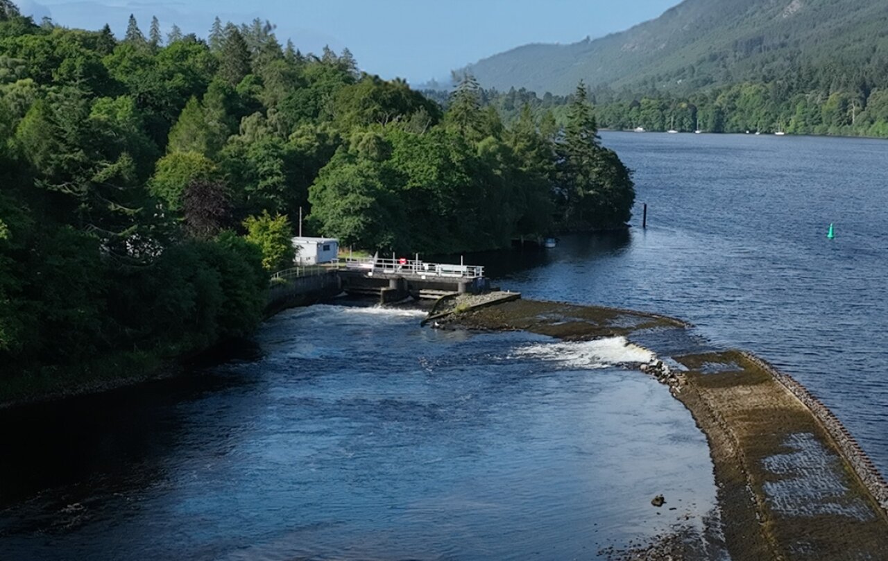
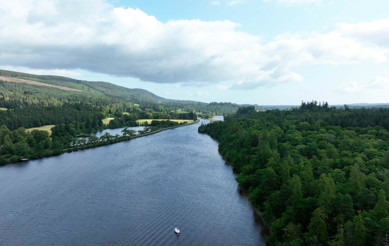
The Caledonian Canal and Loch Ness
Over 200 years ago, the legendary Scottish Civil Engineer Thomas Telford created the engineering marvel the Caledonian Canal. He created an east to west transportation route across Scotland along the Great Glen, including Loch Ness. It comprised a series of lochs and canal locks, as well as bridges and aqueducts, and is still in use today.
Loch Ness is just as important as it ever was, lying at the centre of the Highlands’ economy, providing jobs in tourism, green energy, and utilities.
Ness Weir
Ness Weir was designed to ensure the water levels through Loch Ness and into the Caledonian Canal are maintained at a level which allows boats to transit through the canal. Water levels in Loch Ness are controlled by Ness Weir via existing sluice gates.
A weir is a low-lying structure across a waterway which creates a barrier that raises water levels on the upstream side. Water then spills over the weir crest and water levels are controlled with mechanical structures such as sluice gates or tilting weirs.
The site
The Ness Weir II Proposal
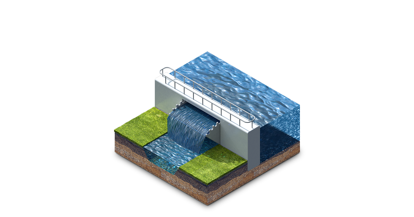
The proposed modifications include raising the crest level of the existing service weir and waste weir, installing new control gates along the service weir and the Dochgarroch eastern embankment, and constructing new fish passes to support aquatic biodiversity. Additionally, we plan to make targeted modifications to the eastern and western Dochgarroch embankments, including localised regrading and raising to create a consistent crest height. These changes will enable more dynamic and responsive management of water levels in Loch Ness throughout the year.
Improving the function of Ness Weir would allow water levels in Loch Ness to be more effectively managed. Ensuring water resilience for all those who depend on the loch.
The Benefits
Supporting Clean Energy
By reducing curtailment of pumped storage hydro during low summer water levels, the project will help maximise renewable energy generation.
Protecting Loch Ness
Improved water resilience will benefit all users of the loch and safeguard sensitive habitats.
Reducing Flood Risk
The proposed operation of Ness Weir II is expected to lower flood risk for Inverness.
Enabling Greener Construction
By facilitating freight movement via the canal, the project will ease pressure on local roads and reduce transport emissions.
Why is the project needed?
Low water levels on Loch Ness can have far-reaching consequences for the region. They impact not only the viability of pumped storage hydro, a cornerstone of Scotland’s clean energy transition, but also affect local businesses, leisure users, the Caledonian Canal, surrounding waterways, and the delicate loch environment.
While Statera’s Loch Kemp Storage project remains viable without changes to the existing weir, long-term projections show increasing water stress within the Loch Ness catchment. This trend is expected to continue regardless of additional pumped storage developments.
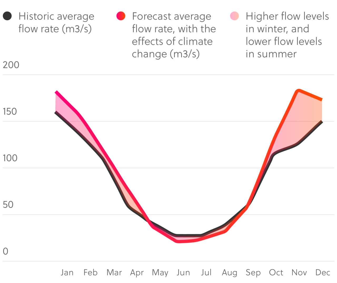
Forecasts predict higher winter flows and lower summer flows
Over the past 40 years, SEPA has carefully monitored how much water flows into the Loch Ness catchment. Their long-term data shows that water levels are changing, and our studies suggest this is due to more extreme and unpredictable weather than we've seen in the past. Climate change is playing a major role. It's causing longer and more frequent periods of low water, especially in the summer.
To help us plan for the future, climate modelling has been carried out as part of the project’s Environmental Impact Assessment. These forecasts show that winters are likely to become wetter, while summers will be drier. On the graph, the blue line shows the historic average monthly flow rate (from 1981 to 2022), and the red line shows what we expect in the future if no changes are made. The shaded area between the two lines highlights the difference in water flow showing how much lower summer flows could be if we don’t act.